-
Libros Antiguos
- Aguilar
- África
- América
- Árabe
- Arte
- Asia
- Ciencias
- Caza
- Derecho
- Economia
- El Libro
- Erótica
- Europa
- Flamenco
- Filología
- Filosofía
- Folklore
- Gastronomía
- Historia
- Judíos
- Literatura
- Local
- Madrid
- Marina
- Medicina
- Militar
- Moda
- Musica
- Periodismo
- Politica
- Religion
- Tauromaquia
- Teatro
- Viajes
- Otras temáticas
- Grabados
- Mapas
- Figurines De Moda
Referencia17696
Referencia no disponible
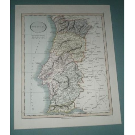
CARY, John
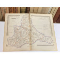
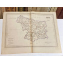
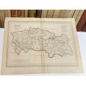
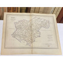
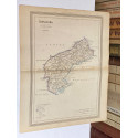
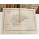
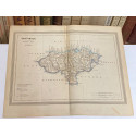
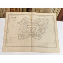
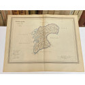
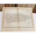
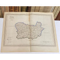
Antiguo mapa de PORTUGAL perteneciente a CARY´S NEW UNIVERSAL ATLAS.
Londres, 1815-1816
Presentado en paspartú. Exterior: 42 x 36 cm. Ventana Interior: 32,50 x 26 cm.
Disponible el:
| Editorial | Londres, 1815-1816 |
| Autor | CARY, John |
Libros relacionados
Antiguo mapa de INDOSTAN SYNDETIC...
CARY, John
Referencia 17698
CARY, John
Antiguo mapa de INDOSTAN SYNDETIC HINDOOSTAN perteneciente a CARY´S NEW UNIVERSAL ATLAS.
Londres, 1815-1816
Presentado en paspartú. Exterior: 42 x 36 cm. Ventana Interior: 32,50 x 26 cm.
Antiguo mapa de SARDINIA CERDEÑA...
CARY, John
Referencia 17703
CARY, John
Antiguo mapa de SARDINIA CERDEÑA perteneciente a CARY´S NEW UNIVERSAL ATLAS.
Londres, 1815-1816
Presentado en paspartú. Exterior: 42 x 36 cm. Ventana Interior: 32,50 x 26 cm.
Partie Septentrionale de la couronne de...
ROBERT DE VAUGONDY.
Referencia 10212
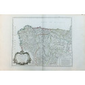
ROBERT DE VAUGONDY.
Partie Septentrionale de la couronne de Casille - MAPA DE ESPAÑA PARTE SEPTENTRIONAL CORONA DE CASTILLA
Año 1752.
Obra: THE ATLAS UNIVERSEL. Medidas: 58 x 85 cm. Plancha: 49 x 62 cm. Pliegue central.
Géographie moderne: MAPA DEL SÁHARA,...
JEAN BAPTISTE...
Referencia 20980
JEAN BAPTISTE LOUIS CLOUET (1729-1790). Cartógrafo y geográfo francés.
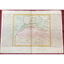
Géographie moderne: MAPA DEL SÁHARA, BARBARIA Y GUINEA (África).
París, chez Mondhare, 1767. 1ª edición.
Mapa grabado al cobre y coloreado, perteneciente a la obra: Géographie moderne. Contiene texto explicativo. Dimensiones de la hoja: 420 x 580 mm. - Dimensiones del mapa: 310 x 36 mm. Con doblez original en el centro.
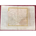
Géographie moderne: MAPA DE EGIPTO (África).
JEAN BAPTISTE...
Referencia 20981
JEAN BAPTISTE LOUIS CLOUET (1729-1790). Cartógrafo y geográfo francés.
Géographie moderne: MAPA DE EGIPTO (África).
París, chez Mondhare, 1767. 1ª edición.
Mapa grabado al cobre y coloreado, perteneciente a la obra: Géographie moderne. Contiene texto explicativo. Dimensiones de la hoja: 420 x 580 mm. - Dimensiones del mapa: 310 x 36 mm. Con doblez original en el centro.
Géographie moderne: MAPA DE GUINEA,...
JEAN BAPTISTE...
Referencia 20982
JEAN BAPTISTE LOUIS CLOUET (1729-1790). Cartógrafo y geográfo francés.
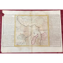
Géographie moderne: MAPA DE GUINEA, MADAGASCAR Y CONGO (África).
París, chez Mondhare, 1767. 1ª edición.
Mapa grabado al cobre y coloreado, perteneciente a la obra: Géographie moderne. Contiene texto explicativo. Dimensiones de la hoja: 420 x 580 mm. - Dimensiones del mapa: 310 x 36 mm. Con doblez original en el centro.
Géographie moderne: MAPA DEL IMPERIO DE LA...
JEAN BAPTISTE...
Referencia 20990
JEAN BAPTISTE LOUIS CLOUET (1729-1790). Cartógrafo y geográfo francés.
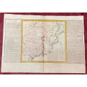
Géographie moderne: MAPA DEL IMPERIO DE LA CHINA (Asia).
París, chez Mondhare, 1767. 1ª edición.
Mapa grabado al cobre y coloreado, perteneciente a la obra: Géographie moderne. Contiene texto explicativo. Dimensiones de la hoja: 420 x 580 mm. - Dimensiones del mapa: 310 x 36 mm. Con doblez original en el centro.
Géographie moderne: MAPA DEL REINO DE...
JEAN BAPTISTE...
Referencia 20993
JEAN BAPTISTE LOUIS CLOUET (1729-1790). Cartógrafo y geográfo francés.
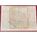
Géographie moderne: MAPA DEL REINO DE HUNGRÍA (Europa: Hungría, Croacia, Eslovenia, Turquía europea, Polonia, Transilvania).
París, chez Mondhare, 1767. 1ª edición.
Mapa grabado al cobre y coloreado, perteneciente a la obra: Géographie moderne. Contiene texto explicativo. Dimensiones de la hoja: 420 x 580 mm. - Dimensiones del mapa: 310 x 36 mm. Con doblez original en el centro.
Géographie moderne: MAPA DE HOLANDA (Europa).
JEAN BAPTISTE...
Referencia 20995
JEAN BAPTISTE LOUIS CLOUET (1729-1790). Cartógrafo y geográfo francés.
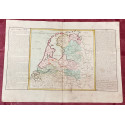
Géographie moderne: MAPA DE HOLANDA (Europa).
París, chez Mondhare, 1767. 1ª edición.
Mapa grabado al cobre y coloreado, perteneciente a la obra: Géographie moderne. Contiene texto explicativo. Dimensiones de la hoja: 420 x 580 mm. - Dimensiones del mapa: 310 x 36 mm. Con doblez original en el centro.
Géographie moderne: MAPA DE SUECIA (Europa).
JEAN BAPTISTE...
Referencia 20996
JEAN BAPTISTE LOUIS CLOUET (1729-1790). Cartógrafo y geográfo francés.
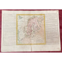
Géographie moderne: MAPA DE SUECIA (Europa).
París, chez Mondhare, 1767. 1ª edición.
Mapa grabado al cobre y coloreado, perteneciente a la obra: Géographie moderne. Contiene texto explicativo. Dimensiones de la hoja: 420 x 580 mm. - Dimensiones del mapa: 310 x 36 mm. Con doblez original en el centro.
Géographie moderne: MAPA DE SUIZA (Europa).
JEAN BAPTISTE...
Referencia 20998
JEAN BAPTISTE LOUIS CLOUET (1729-1790). Cartógrafo y geógrafo francés.
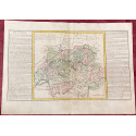
Géographie moderne: MAPA DE SUIZA (Europa).
París, chez Mondhare, 1767. 1ª edición.
Mapa grabado al cobre y coloreado, perteneciente a la obra: Géographie moderne. Contiene texto explicativo. Dimensiones de la hoja: 420 x 580 mm. - Dimensiones del mapa: 310 x 36 mm. Con doblez original en el centro.
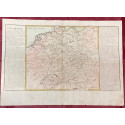
Géographie moderne: MAPA DE ALEMANIA...
JEAN BAPTISTE...
Referencia 20999
JEAN BAPTISTE LOUIS CLOUET (1729-1790). Cartógrafo y geógrafo francés.
Géographie moderne: MAPA DE ALEMANIA (Europa).
París, chez Mondhare, 1767. 1ª edición.
Mapa grabado al cobre y coloreado, perteneciente a la obra: Géographie moderne. Contiene texto explicativo. Dimensiones de la hoja: 420 x 580 mm. - Dimensiones del mapa: 310 x 36 mm. Con doblez original en el centro.
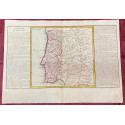
Géographie moderne: MAPA DE PORTUGAL Y...
JEAN BAPTISTE...
Referencia 21007
JEAN BAPTISTE LOUIS CLOUET (1729-1790). Cartógrafo y geógrafo francés.
Géographie moderne: MAPA DE PORTUGAL Y PARTE DE ESPAÑA.
París, chez Mondhare, 1767. 1ª edición.
Mapa grabado al cobre y coloreado, perteneciente a la obra: Géographie moderne. Contiene texto explicativo. Dimensiones de la hoja: 420 x 580 mm. - Dimensiones del mapa: 310 x 36 mm. Con doblez original en el centro.
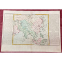
Géographie moderne: MAPA CON LAS ISLAS,...
JEAN BAPTISTE...
Referencia 21010
JEAN BAPTISTE LOUIS CLOUET (1729-1790). Cartógrafo y geógrafo francés.
Géographie moderne: MAPA CON LAS ISLAS, CABOS Y PUERTOS DE LOS MARES DE ASIA.
París, chez Mondhare, 1767. 1ª edición.
Mapa grabado al cobre y coloreado, perteneciente a la obra: Géographie moderne. Contiene texto explicativo. Dimensiones de la hoja: 420 x 580 mm. - Dimensiones del mapa: 310 x 36 mm. Con doblez original en el centro.
Géographie moderne: MAPA CON LAS RIVERAS Y...
JEAN BAPTISTE...
Referencia 21013
JEAN BAPTISTE LOUIS CLOUET (1729-1790). Cartógrafo y geógrafo francés.
Géographie moderne: MAPA CON LAS RIVERAS Y PRINCIPALES MONTAÑAS DE AMÉRICA.
París, chez Mondhare, 1767. 1ª edición.
Mapa grabado al cobre y coloreado, perteneciente a la obra: Géographie moderne. Contiene texto explicativo. Dimensiones de la hoja: 420 x 580 mm. - Dimensiones del mapa: 310 x 36 mm. Con doblez original en el centro.
Géographie moderne: MAPA CON LAS RIVERAS Y...
JEAN BAPTISTE...
Referencia 21014
JEAN BAPTISTE LOUIS CLOUET (1729-1790). Cartógrafo y geógrafo francés.
Géographie moderne: MAPA CON LAS RIVERAS Y PRINCIPALES MONTAÑAS DE EUROPA.
París, chez Mondhare, 1767. 1ª edición.
Mapa grabado al cobre y coloreado, perteneciente a la obra: Géographie moderne. Contiene texto explicativo. Dimensiones de la hoja: 420 x 580 mm. - Dimensiones del mapa: 310 x 36 mm. Con doblez original en el centro.
Géographie moderne: MAPA CON LAS ISLAS,...
JEAN BAPTISTE...
Referencia 21015
JEAN BAPTISTE LOUIS CLOUET (1729-1790). Cartógrafo y geógrafo francés.
Géographie moderne: MAPA CON LAS ISLAS, CABOS Y PUERTOS DE LOS MARES DE EUROPA.
París, chez Mondhare, 1767. 1ª edición.
Mapa grabado al cobre y coloreado, perteneciente a la obra: Géographie moderne. Contiene texto explicativo. Dimensiones de la hoja: 420 x 580 mm. - Dimensiones del mapa: 310 x 36 mm. Con doblez original en el centro.
Mapa de PALENCIA perteneciente al Atlas...
FERREIRO, Martín.
Referencia 21180
FERREIRO, Martín.
Mapa de PALENCIA perteneciente al Atlas Geográfico de España.
Madrid, Imprenta y Librería de Gaspar y Roig, 1864.
Grabado al acero. Límites coloreados. Tamaño hoja: 32 x 26 cm. Con pliegue central.
Mapa de CASTELLÓN perteneciente al Atlas...
FERREIRO, Martín.
Referencia 21181
FERREIRO, Martín.
Mapa de CASTELLÓN perteneciente al Atlas Geográfico de España.
Madrid, Imprenta y Librería de Gaspar y Roig, 1864.
Grabado al acero. Límites coloreados. Tamaño hoja: 32 x 26 cm. Con pliegue central.
Mapa de ZARAGOZA perteneciente al Atlas...
FERREIRO, Martín.
Referencia 21182
FERREIRO, Martín.
Mapa de ZARAGOZA perteneciente al Atlas Geográfico de España.
Madrid, Imprenta y Librería de Gaspar y Roig, 1864.
Grabado al acero. Límites coloreados. Tamaño hoja: 32 x 26 cm. Con pliegue central.
Mapa de ZAMORA perteneciente al Atlas...
FERREIRO, Martín.
Referencia 21183
FERREIRO, Martín.
Mapa de ZAMORA perteneciente al Atlas Geográfico de España.
Madrid, Imprenta y Librería de Gaspar y Roig, 1864.
Grabado al acero. Límites coloreados. Tamaño hoja: 32 x 26 cm. Con pliegue central.
Mapa de TOLEDO perteneciente al Atlas...
FERREIRO, Martín.
Referencia 21187
FERREIRO, Martín.
Mapa de TOLEDO perteneciente al Atlas Geográfico de España.
Madrid, Imprenta y Librería de Gaspar y Roig, 1864.
Grabado al acero. Límites coloreados. Tamaño hoja: 32 x 26 cm. Con pliegue central.
Mapa de TERUEL perteneciente al Atlas...
FERREIRO, Martín.
Referencia 21188
FERREIRO, Martín.
Mapa de TERUEL perteneciente al Atlas Geográfico de España.
Madrid, Imprenta y Librería de Gaspar y Roig, 1864.
Grabado al acero. Límites coloreados. Tamaño hoja: 32 x 26 cm. Con pliegue central.
Mapa de TARRAGONA perteneciente al Atlas...
FERREIRO, Martín.
Referencia 21189
FERREIRO, Martín.
Mapa de TARRAGONA perteneciente al Atlas Geográfico de España.
Madrid, Imprenta y Librería de Gaspar y Roig, 1864.
Grabado al acero. Límites coloreados. Tamaño hoja: 32 x 26 cm. Con pliegue central.
Mapa de SEGOVIA perteneciente al Atlas...
FERREIRO, Martín.
Referencia 21192
FERREIRO, Martín.
Mapa de SEGOVIA perteneciente al Atlas Geográfico de España.
Madrid, Imprenta y Librería de Gaspar y Roig, 1864.
Grabado al acero. Límites coloreados. Tamaño hoja: 32 x 26 cm. Con pliegue central.
Mapa de SANTANDER perteneciente al Atlas...
FERREIRO, Martín.
Referencia 21193
FERREIRO, Martín.
Mapa de SANTANDER perteneciente al Atlas Geográfico de España.
Madrid, Imprenta y Librería de Gaspar y Roig, 1864.
Grabado al acero. Límites coloreados. Tamaño hoja: 32 x 26 cm. Con pliegue central.
Mapa de SALAMANCA perteneciente al Atlas...
FERREIRO, Martín.
Referencia 21194
FERREIRO, Martín.
Mapa de SALAMANCA perteneciente al Atlas Geográfico de España.
Madrid, Imprenta y Librería de Gaspar y Roig, 1864.
Grabado al acero. Límites coloreados. Tamaño hoja: 32 x 26 cm. Con pliegue central.
Mapa de PONTEVEDRA perteneciente al Atlas...
FERREIRO, Martín.
Referencia 21195
FERREIRO, Martín.
Mapa de PONTEVEDRA perteneciente al Atlas Geográfico de España.
Madrid, Imprenta y Librería de Gaspar y Roig, 1864.
Grabado al acero. Límites coloreados. Tamaño hoja: 32 x 26 cm. Con pliegue central.
Mapa de OVIEDO perteneciente al Atlas...
FERREIRO, Martín.
Referencia 21196
FERREIRO, Martín.
Mapa de OVIEDO perteneciente al Atlas Geográfico de España.
Madrid, Imprenta y Librería de Gaspar y Roig, 1864.
Grabado al acero. Límites coloreados. Tamaño hoja: 32 x 26 cm. Con pliegue central.
Mapa de ORENSE perteneciente al Atlas...
FERREIRO, Martín.
Referencia 21197
FERREIRO, Martín.
Mapa de ORENSE perteneciente al Atlas Geográfico de España.
Madrid, Imprenta y Librería de Gaspar y Roig, 1864.
Grabado al acero. Límites coloreados. Tamaño hoja: 32 x 26 cm. Con pliegue central.

